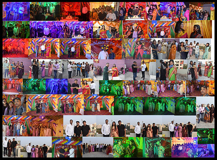
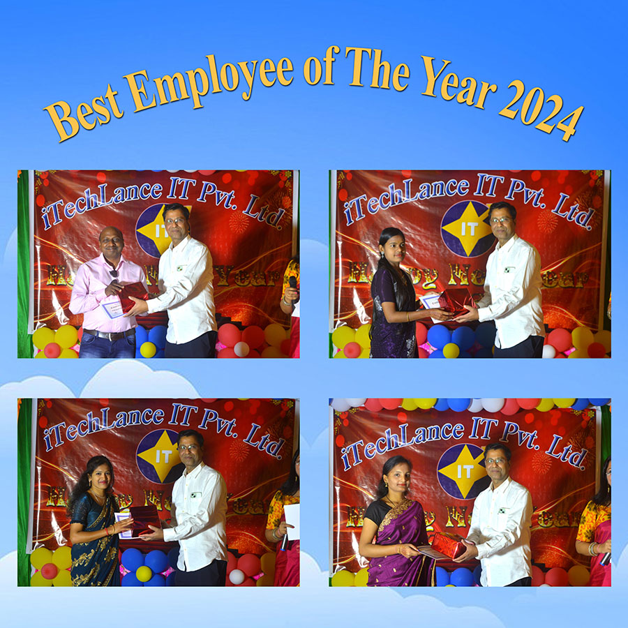
The new year celebration 2025
We bid farewell to the past year welcomed the New Year with enthusiasm and hope. The day began with a moving devotional song, setting a reflective tone. We celebrated our past year's accomplishments, recogni....
From the point cloud to 2D CAD
From the point cloud to 3D model
CAD plans according to your specifications
We deliver technical drawings that are not only precise, but also really
make a difference.
CAD plans, GIS, Utility Mapping, Point Cloud to CAD
as well as Survey Manhole and telecom Tower drawings – iTechLance
makes your technology visible.
Creation of CAD data from a point cloud For property management
ITechlance IT stands as a premier provider of comprehensive GIS, CAD, and 3D Visualization Services for clients across the globe. The organization combines extensive industry knowledge, robust financial stability, a proficient workforce, and 14+ years of experience to address a diverse range of client requirements in geospatial and IT services. Established in 2010, ITechlance IT is an ISO 9001:2015 certified company located in Bhubaneswar, Odisha, India.
The company has earned a solid reputation for delivering dependable, quality-focused, cost-effective, and highly competitive services and solutions. We are recognized as one of the largest providers in areas such as CAD drafting, CAD data conversion, point cloud processing, GIS data conversion, 3D modeling and visualization, floor plans for real estate marketing, point cloud to CAD conversion, 3D Revit modeling, utility mapping, LiDAR Mapping,Photogrammetry and Remote Sensing.
i-TechLance IT stands as a premier provider of comprehensive GIS, CAD, and 3D Visualization Services for clients across the globe. Our expertise is rooted in extensive experience in CAD drafting, data conversion, GIS data transformation, and 3D modeling.
The management and organization of ever-increasing document volumes have presented significant challenges. Converting these documents into a digital format through scanning has emerged as the most efficient method for their preservation. This procedure is commonly referred to as paper to CAD conversion.
We provide thorough paper to CAD conversion services, including PDF to DWG conversion, executed with precise accuracy at highly competitive prices. Our capabilities extend to all types of drawings, including Mechanical, Electrical, Architectural, HVAC, Maps, Plumbing, and more....
We provide services for converting Point Cloud data into 2D and 3D formats.
Point Cloud to CAD Services are essential for reconstructing building conditions. When renovations or reconstructions are needed, converting Point Cloud data is crucial. Using software like Revit and AutoCAD, cloud data can be efficiently turned into 2D drawings or 3D models. To ensure precision and detail, 3D laser scanners capture cloud point data from new building scans. Raw data is converted to cloud files, and then transformed into 3D CAD models for accuracy and quality. i-TechLance IT has been a leader in providing top-quality point cloud conversion services for many years. Our expert team transforms raw point cloud data into CAD files using AutoCAD software, with a preference for laser scan data....
Our GIS Data Conversion services are offered at extremely competitive prices that make us unique among all other service providers in the same discipline. Our richly experienced team of GIS professionals can deliver with high quality and lowest ever turnaround time as per the specification
Our lab is equipped with state-of-the art facilities. We can cater to any type of requirements. Our services are intended to meet the diverse needs of our clientele quickly and efficiently. Our project methodologies are based on the unique set of customer requirements and challenges.
We've a dedicated & extremely motivated set of employees whose sole aim is to provide services to our clients with a high level of quality. We regularly provide them training on latest technologies to keep them abreast of the latest technology in this service industry...
At i-TechLance, we offer cutting-edge digital photogrammetry solutions that combine advanced technology with precision to provide highly accurate and efficient results for a variety of industries. Our photogrammetry services are designed to help you capture, process, and analyze 3D spatial data from digital images. Whether you're in construction, architecture, land surveying, or environmental monitoring, our solutions can streamline your workflow and improve project outcomes.
We offer aerial and terrestrial photogrammetry services for diverse project needs using drones, aircraft, and ground-based cameras. Our 3D modeling creates high-res models for various applications like architecture. Land surveys are conducted efficiently with drone-captured images. Infrastructure inspection is done with high-res imagery for damage evaluation. Our outputs integrate seamlessly with GIS for informed decisions. Custom solutions tailored to meet the unique needs of each project are available with expert guidance.
Our LiDAR surveying services provide highly accurate 3D point cloud data for land surveys, civil engineering, and environmental monitoring using advanced airborne or terrestrial systems, generating precise models, topography, and elevation maps.
Mobile LiDAR captures detailed 3D data while in motion for roadways, bridges, and urban infrastructure. LiDAR aids asset management and infrastructure monitoring by tracking conditions, detecting changes, and mapping physical assets. It enables accurate 3D modeling for design and visualization in construction, architecture, and urban planning.
LiDAR technology is vital for collecting topographic and environmental data in remote areas for forestry mapping, flood risk assessment, and environmental impact studies. LiDAR data integrates seamlessly with GIS for advanced spatial analysis like terrain feature analysis and geospatial reporting tailored to specific needs.
i-TechLance specializes in a comprehensive range of GIS services, including GIS Remote Sensing, GIS Mapping, and GIS Data Conversion services. Our offerings enable the visualization of geographic data, facilitate the analysis of spatial relationships, and enhance data management efficiency. Through our GIS data conversion services, we integrate data from various sources into a unified format, ensuring seamless access, analysis, and application.
Utilizing both paper and electronic data, whether sourced from our clients or collected independently, i-Tech Lance performs GIS data conversions and creates electronic maps leveraging advanced Geographic Information Systems (GIS) technology.
In delivering our GIS Mapping Services, i-TechLanceis dedicated to employing cutting-edge technology, ongoing research, and innovation, all executed by our highly skilled and experienced team. With over 15 years of expertise, our engineers and planners have developed GIS products and systems that are integrated with GPS, GIS, and CAD technologies.
i-TechLance IT stands as a premier provider of Utility Mapping (AM/FM) services for various electrical networks, water pipe systems, gas pipelines, telephone line networks, power line infrastructures, sewage systems, and more, catering to clients globally.
Our team of seasoned professionals is well-versed in a diverse array of Utility Mapping software solutions. We utilize advanced software in our Utility Mapping systems.
The utilization of GIS software allows for the updating and visualization of mapping results, as well as the querying of databases. These mapping outcomes can be exported in .DWG and .SHP formats, which can be projected into either Local or World Coordinate Systems. The databases associated with .DWG and .SHP files may include information derived from various fields, in addition to data provided by the client.
Our organization is committed to ensuring a high degree of customer satisfaction. Our personnel are well-trained, motivated, and supported to effectively manage projects. We consistently offer training on the latest technologies to our staff. Our pricing remains highly competitive......
Minimize Redundancy in Expansion or Renovation with Scan to BIM
i-TechLance IT offers Point Cloud to BIM and Scan to BIM modeling services, possessing extensive experience across various levels of detail. We generate precise 3D BIM models from Point Cloud data for clients in the construction, architectural, and engineering sectors, catering to their refurbishment, renovation, and reconstruction needs, as well as for information gathering.
The Scan to BIM process involves documenting existing buildings or structures to utilize a digital planning approach known as Building Information Modeling (BIM). Our team comprises qualified and experienced professionals who effectively employ a range of tools related to scan to BIM, facilitating the conversion of laser-scanned Point Cloud data into comprehensive 3D models....
The unique selling proposition of i-TechLance IT lies in its expertise in 3D Visualization. The primary objective is to develop 3D architectural models that incorporate comprehensive real-world details. This approach achieves a high degree of photorealism, allowing stakeholders to visualize a product before its actual production. By eliminating uncertainty, 3D Visualization facilitates a seamless project development process.
In the fields of architecture and interior design, 3D Visualization is frequently employed to produce lifelike renderings of buildings and spaces. It serves to transform 2D drawings into three-dimensional representations, highlighting both advantageous and potentially disadvantageous aspects before the commencement of physical construction. Additionally, it complements traditional illustrations of materials, finishes, fixtures, and fittings....
Quality assurance goes beyond manual testing, as modern systems require advanced methodologies. Automated testing techniques can autonomously identify errors, reducing costs and time by over 80% compared to traditional methods, while improving system uptime....
Choosing i-TechLanceas your partner offers numerous benefits. As a trusted and rapidly expanding brand, we focus on client development and provide a wide range of services, especially in CAD and GIS. Our growth enhances our ability to handle projects that showcase ....